 |
 |
|
|
|
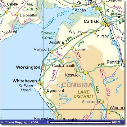
How to Find Cockermouth : From the South - exit the M6 at Penrith, junction 40, and take the A66 to Cockermouth (33 miles). At the roundabout beside the Lakeland Sheep and Wool Centre, turn right into Cockermouth. From the North - Follow the A595 to Belle Vue Roundabout above Cockermouth. Take the turning to Cockermouth, following the road down into town, going over the river bridge and turning left at the mini roundabout. By Train - Take the train to Penrith, on the West Coast Main Line, then take the X5 Bus from Penrith station to Cockermouth. See the map on Tourist Attractions menu for the location of car parks. Image produced from the Ordnance Survey Get-a-map service, and reproduced with kind permission of Ordnance Survey. |
|
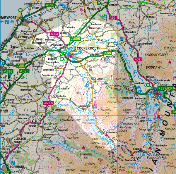
For maps of the Cockermouth area, use Multimap.com. You can enter a postcode, grid reference, or house name/number and street and town, and get an Ordnance Survey map at a variety of scales with your chosen location circled.
1:10000 scale will give you street names. 1:25000 is the yellow OS map. 1:100000 shows roughly the coverage of this site.
The 25000 scale (2.5 in to the mile) map with Cockermouth at its centre is at Cockermouth 1:25000 OS map.
You could also try the new Google map of Cockermouth. Click and drag the mouse to pan. Use the zoom buttons to zoom in (giving street map level) and out.
Coverage of this site is the CA13 postcode area, as highlighted above, which includes:
|
|
|
| Main Menu
| | |