Allerdale Planning 2014-2029
The local authority, Allerdale said in 2013/14
it was seeking views on its medium term plans for Cockermouth
housing. The following maps show some of the possible options
for discussion. Potential bad news for town centre traders is
the inclusion of a possible 'retail' allocation of land north
of Hames Hall (Marked in sky blue). If developed this would no
doubt take business away from the town centre. While the plan
indicates possible housing allocations (in purple) in the future
the council do state that: "76% of the houses that are needed
to meet our target for Cockermouth up to 2029 have already been
built or have permission" To view the original document for
a clearer view a copy of the Allerdale document and plans can
be found here: More
info...
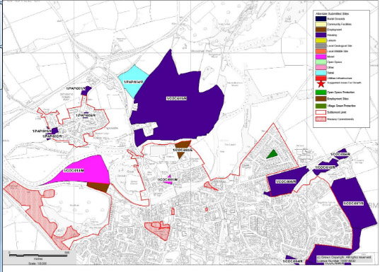
The planning map for North Cockermouth.
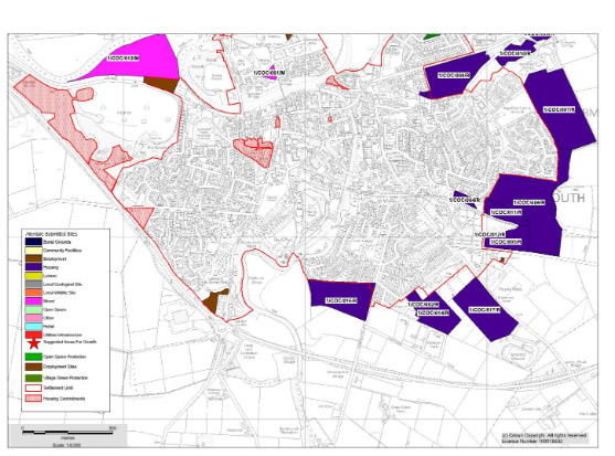
The planning map for south Cockermouth.
To view the original PDF document for clearer view a copy of the Allerdale document can be found here: More info...
The planning map for North Cockermouth.
The planning map for south Cockermouth.
To view the original PDF document for clearer view a copy of the Allerdale document can be found here: More info...